California has been in something of a dry spell for the last few years. 85% of the state is in Severe Drought, thanks to climate change. Unfortunately the flip side is sometimes we just get absolutely hammered with rain. Back in October of 2021 my local rain gauge registered 7 inches of precipitation. Since then we’ve gotten almost no rain… well until the last month. Early in December we got just over an inch of rain, nice to see. Between December 26th and 30th, we received a total of 3 inches of precipitation which nicely saturated everything Then December 31st we got hammered by an Atmospheric river which totaled 5 inches of rain, delivered almost entirely in about 14 hours.
Some areas got it worse than others. Danville saw some neighbors being flooded. There were numerous mudslides and flooded homes across the Bay. Highway 101 in South San Francisco was closed for hours due to flooding. Over the Sierra’s, I-80 was closed due to multiple accidents and spinouts and Highway 50 was closed for many hours due to avalanche control. According to the National Weather Service, this was the 2nd wettest day in San Francisco’s history in 170 years.

However, I was out in the Concord area and was curious so I did some exploring/investigation to the local status and it was, to no shock to anyone, crazy. Amounts of water we never see in California. Rather than talking about it though, I have pictures and videos to share.


The first location is Bancroft road at the crossing of “Walnut Creek” (technically a stream). This stream/land is owned by the Contra Costa Count Flood Control & Water Conservation District. You can see from the above images that there is not much water in these canals. The Street View shot is from September, so its fairly representative of what we see, mostly dry.
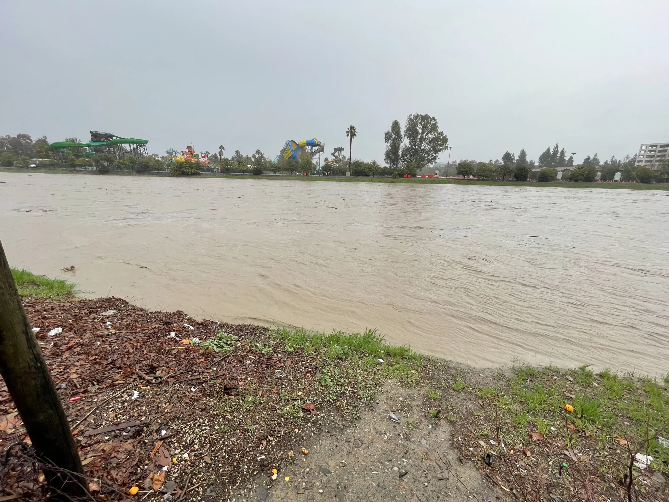
The videos speak for themselves, that is a LOT of water. A spoke to a neighbor who lived just a few houses down from the flood canal and he said that in the 30 years he’s lived there, he’s never seen anything like this. I’m neither a expert in soil science nor hydrology, but I expect the ground had reached maximum saturation this week and… we just don’t have 5 inches of rain in a day basically ever. As the records have shown. Also to give more context, I went back 24 hours later to the same location.
Unfortunately there is no active stream gauge in that area of the canals, nor are there depth markings or similar easy way to judge depth. It’s also dangerous to climb into drainage canals, so we won’t be doing that either. If I had to guess, I’d say during peak there was something on the range of 10-20 feet of water. In Downtown Walnut Creek (the city) on the same stream (this is the problem with naming a city after a feature in the city), there is a “river” gauge. At about 2:45pm the peak level was 11 feet, compared to 0.3 feet deep 2 weeks earlier.

Eventually I moved downstream to the Ironhorse Trail near Willow Way, in Concord. This is right across the “stream” (same Walnut Creek stream) from Six Flags Hurricane Harbor. At this point in time the drainage canals are roughly 350 feet (107 meters) wide. The driftwood, the water is also moving at a solid clip. I’m sure someone could do the math and figure out how much water is moving here… but I’m just going with “a lot”.
While I did not go back later to check on how the water level looked. Here is a view from Google again.


The Street View image is from 2009 with the right most satellite shot being from August 2022. This is what we’re used to seeing these days. A mostly empty creek bed with just the tiniest amount of water struggling through the bottom.
Now before you say “Yay, Clearly this will help California’s water problems”. Sorry to disappoint. These flood control canals drain directly into Suisun Bay, which is one of the last stops before running into the San Francisco Bay and… the ocean. So we’re fortunate that these help make sure the East Bay don’t flood (well, it doesn’t help Danville, obviously), but they do not help our reservoirs. But let’s not end on a total down note….

While Lake Oroville (just to take one famous dam) is only at 37% at of January 1st, 2023 – that is up from 30% just a week earlier (January 26th, 2022).
And to be even more cheerful, as I write this on Monday January 2nd, it’s raining again – only a little bit today (0.5″ forecast). Tomorrow we’re expecting a second atmospheric river / bomb cyclone to hit with another 4-7″ inches of precipitation. Looking forward to my lawn turning into a swamp…again.
